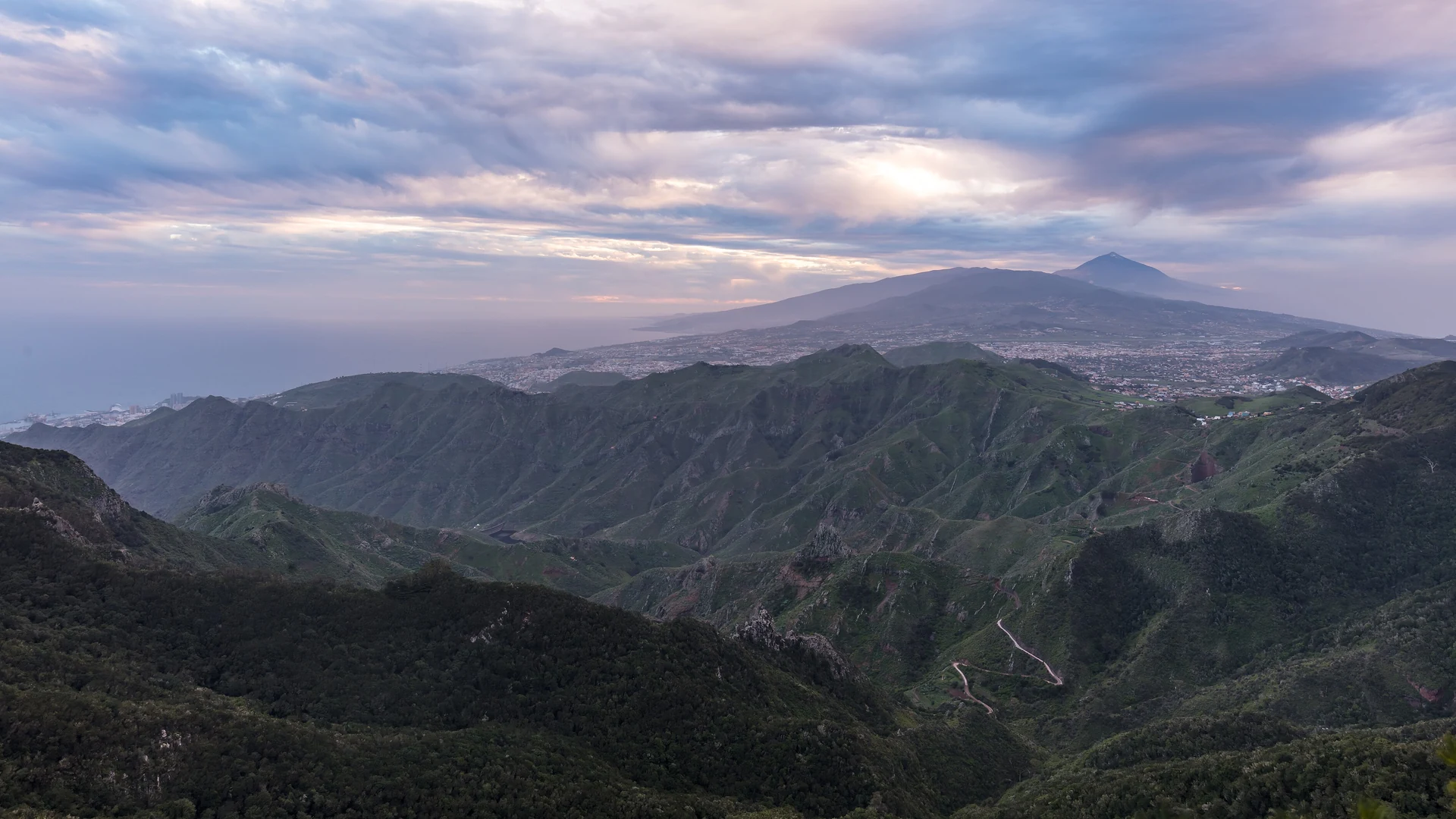
Anaga is the north-eastern end of Tenerife, and it is the part of the island that looks nothing like the brochure. Roughly 14,500 hectares of ridges, one-lane roads and laurel forest, spread across three municipalities, declared a UNESCO Biosphere Reserve in 2015 for holding one of the highest concentrations of endemic species in Europe.
The practical headline is better than most people expect. Almost all of Anaga is free to walk, with no permit and no parking charge. The exception is a small number of strictly protected enclaves, and one of them, the so-called enchanted forest, is capped at 45 people a day.
Most of Anaga needs no permit at all
Start with what is not restricted, because guides routinely imply the whole massif is gated. The waymarked trail network out of the main access points, the villages, the viewpoints and the beaches are all open access. You turn up and walk.
That includes the best-known short route, the Sendero de los Sentidos at Cruz del Carmen, and the longer paths dropping north towards Taganana. No booking, no fee.
What is restricted is a set of enclaves with the highest level of environmental protection, and those need a permit issued in your name. It is worth knowing which they are before you plan a route around one by accident.
The permits: which areas, and how the booking works
Four areas carry controlled access. Three are Integral Natural Reserves: El Pijaral, home to the Sendero del Bosque Encantado and the one most visitors are chasing, plus Ijuana and Los Roques de Anaga. The fourth is Monte de Aguirre, an old laurel forest protected for its singular conditions.
The mechanics are the same across them and they are unusual enough to be worth spelling out:
- Cost: free. There is no charge for the permit itself.
- Capacity: a maximum of 45 people per day.
- Who it covers: the booking is nominal, and can include up to four companions.
- Where to book: centralreservas.tenerife.es, or the Tenerife ON app.
- When slots open: every Monday at 07:00 Canary time, releasing places for the following week.
- How far ahead: a maximum of 14 days in advance.
That Monday-morning release is the whole game. With 45 places a day and a weekly drop, popular dates go quickly, and there is no way to book months out the way you might for the Teide summit.
The laurel forest is the actual attraction
The reason Anaga is protected at all is laurisilva, subtropical laurel forest that covered the Mediterranean basin around 40 million years ago and was wiped out almost everywhere else by climate change. Here it survived, because the trade winds hitting these ridges hold a permanent humid microclimate over them.
What that looks like on the ground is low cloud sitting in the trees, moss on twisted trunks and a green that has no business being on the same island as the southern desert coast. The official description of it as a living fossil is not marketing.
It also explains the weather. Anaga is frequently damp and cool when the south is dry and hot, and the cloud that makes the forest is the same cloud that will sit on you all afternoon. Take a layer and expect wet rock underfoot.
Why it feels like a different island
The contrast with the south is not a matter of degree. Southern Tenerife sits in the rain shadow of the central massif, which strips the moisture out of the trade winds before they arrive. Anaga is on the side that catches all of it.
That single mechanism produces everything you notice here: the forest, the cloud, the greenness, the cooler air, and the fact that the villages are farming settlements rather than resorts. It is also why the park holds one of the highest concentrations of endemic species anywhere in Europe, which is what the Biosphere Reserve designation is actually recognising.
Practically, it means Anaga is often the answer when the south is too hot rather than a fallback when it rains. The where to stay in Tenerife guide sets out how sharply the two coasts diverge and what that means for booking.
Cruz del Carmen: where to start
The Cruz del Carmen visitor centre is the standard entry point, sitting at the heart of the protected area with a permanent exhibition, route advice and audiovisual material. It opens Monday to Sunday, 09:30 to 16:00, which is earlier than most people plan for.
Beside it is the mirador, with the massif on one side and, on a clear day, the silhouette of Teide across the island. It is also where the Sendero de los Sentidos begins, which is the right first walk if you want the forest without committing to a full day.
Go to the centre first even if you know your route. It is where you find out whether a trail is closed, which happens more often here than anywhere else on the island.
Chinamada, Taganana and the villages
There are 26 small villages and hamlets inside the park, and two are worth going out of your way for.
Chinamada is a hamlet of around 30 cave houses cut into the rock face, still lived in rather than preserved as an exhibit, with a restaurant built into the same cliff. The walk out from it towards Punta del Hidalgo is one of the best in the park.
Taganana is the main settlement and one of the oldest villages on Tenerife. The detail that explains it: until 1968 it was reachable only by boat. The road changed what the village is, but the layout, whitewashed houses stacked into the hillside above terraces, still reflects the centuries before it.
The beaches are for looking at, mostly
The north coast below Taganana holds the island's black-sand coves, Benijo and Almáciga the best known. They are the scenic payoff of the drive down and they are not casual swimming beaches.
Our best beaches in Tenerife guide is direct about why, including the currents at Benijo and the absence of lifeguard cover. Read that before anyone in your party gets in the water.
Getting there, and how long you need
Access is by the TF-11 and TF-12 roads from La Laguna, and by TITSA bus on several routes including lines 945 and 947. The roads are narrow, steep and slow, and the driving time is always longer than the map suggests.
Doing it without a car is possible but restrictive: the buses reach the main points and not the trailheads between them. This is the strongest case on the island for hiring one, which our Tenerife car hire guide covers.
Give it a full day minimum, and two if you want a permit walk as well as the villages and the coast. The nearest sensible base is the north coast rather than the southern resorts, and the Puerto de la Cruz guide covers the closest town of any size. For how Anaga fits alongside the island's other headline attractions, see the things to do in Tenerife guide.
FAQ – visiting Anaga Rural Park
Featured image: Diego Delso / Wikimedia Commons / CC BY-SA 4.0